Los Glaciares National Park: Complete Visitor Guide and Maps
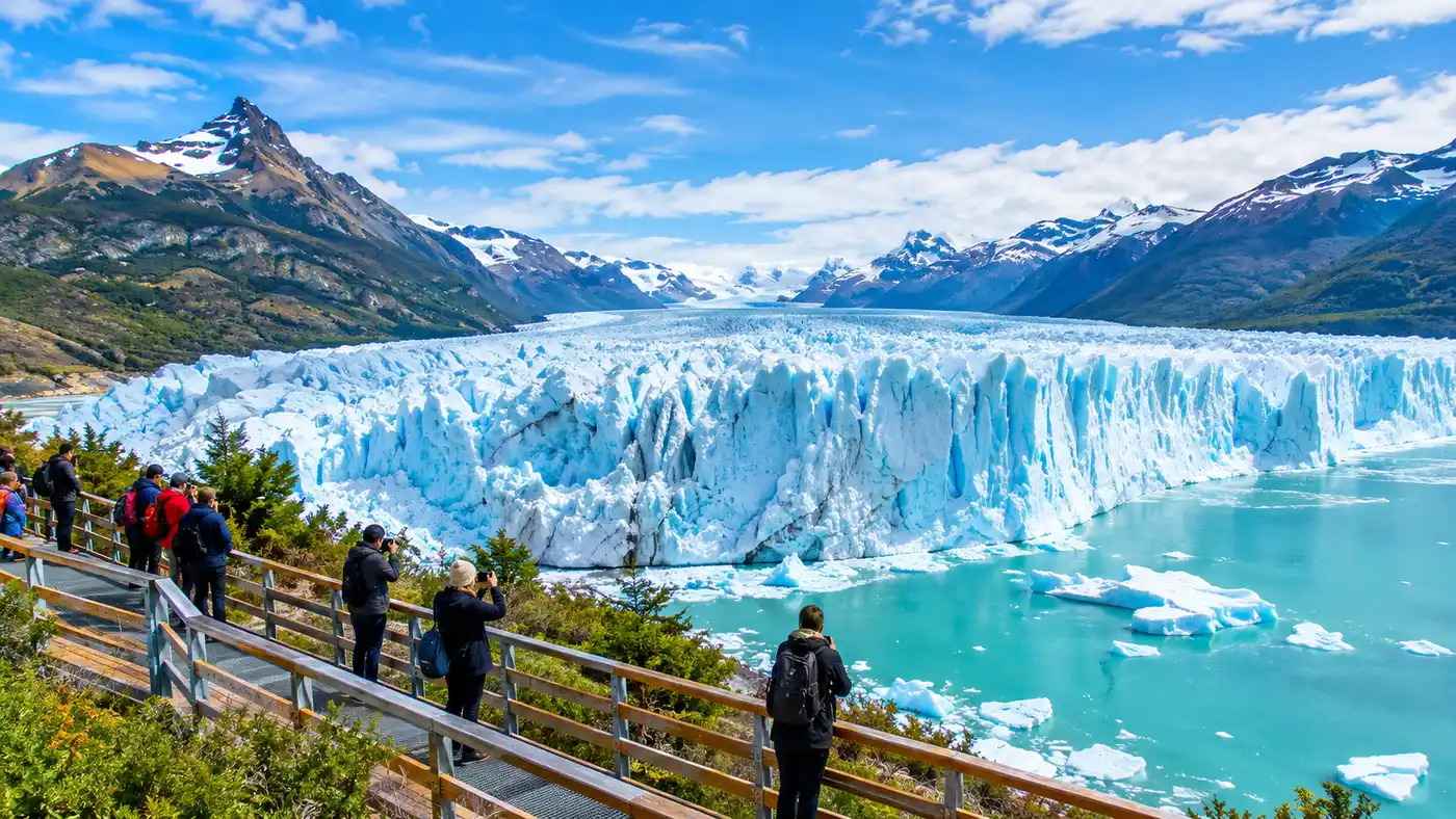
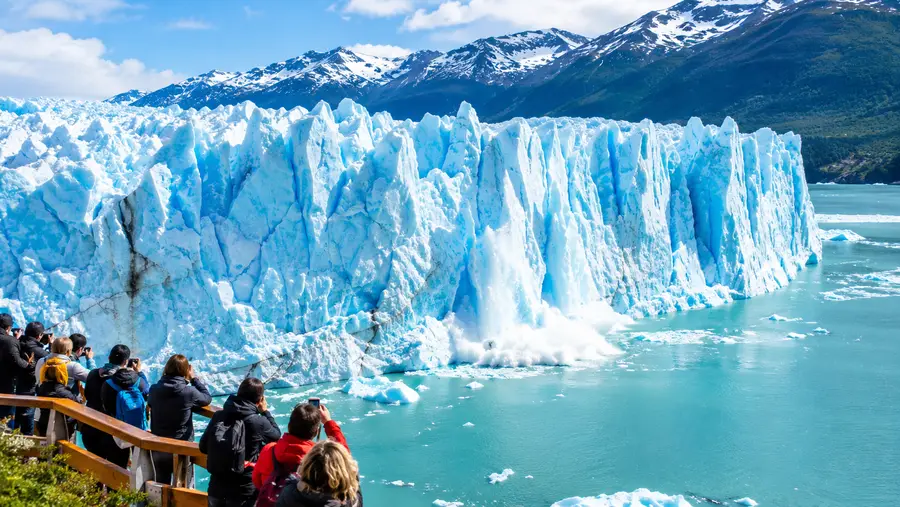
You hear the ice before you see it. Standing on the wooden walkways above the southern arm of Lake Argentino, the sound carries across the water like artillery fire, sharp cracks that echo against the granite peaks before a slab of white ice shears off into the milky turquoise water below. This is los glaciares national park, a 7,269-square-kilometer stretch of southern Patagonia that holds the largest ice cap outside of Antarctica and Greenland. It is wild, raw, and surprisingly easy to access if you know how to navigate the distances.
Most travelers arrive thinking the park is a single valley or a compact reserve you can conquer in a weekend. It isn't. Known locally as Parque Nacional Los Glaciares, this UNESCO World Heritage site is effectively split into two distinct sectors separated by three hours of dry, wind-scoured Patagonian steppe. Down south sits El Calafate, the gateway to Perito Moreno and the great southern lakes. Up north sits El Chaltén, Argentina's trekking capital, crouched under the jagged teeth of Mount Fitz Roy and Cerro Torre. Planning a trip here requires understanding how these pieces fit together, because moving between them takes time and effort.
Book your perito moreno glacier tour experience:
Understanding the Layout: North vs South in Los Glaciares National Park
Geography dictates everything in this corner of Santa Cruz province. Many first-timers ask where is Perito Moreno glacier located and assume they can hike directly from their hotel room to Fitz Roy the next morning. The park stretches along the Chilean border for roughly 170 kilometers from north to south, hemmed in by the Southern Patagonian Ice Field to the west and the arid steppe to the east. The mountains block moisture rolling in from the Pacific, dumping snow on the high peaks and creating fierce winds that blow across the lower plains at 80 kilometers per hour on typical afternoons.
The southern hub is El Calafate. It is a paved, tourist-oriented town sitting on the shore of Lago Argentino, filled with chocolate shops, gear rental outfits, and steakhouses grilling lamb over open fires. From here, you drive 78 kilometers west along Provincial Route 11 to reach the Magallanes Peninsula, where the famous Perito Moreno glacier in Los Glaciares National Park terminates directly against the land. This southern sector is about water, boat rides, and towering walls of ice.
The northern sector belongs entirely to El Chaltén. Founded in 1985 during a border dispute with Chile, it feels like an Alpine outpost that decided to drop itself into the middle of nowhere. There are no massive bus parking lots or manicured walkways here. Trails start straight from the edge of town, leading day hikers and backpackers up into glacial valleys, beech forests, and scree fields below granite towers. If you want self-guided hikes, you head north. If you want to witness massive ice walls calving into lakes, you stay south.
| Feature | Southern Sector (El Calafate) | Northern Sector (El Chaltén) |
|---|---|---|
| Main Base Town | El Calafate | El Chaltén |
| Primary Draw | Perito Moreno, Upsala, Spegazzini | Mount Fitz Roy, Cerro Torre, Laguna de los Tres |
| Trail Network | Steel catwalks (approx. 4.7 km total) | Over 100 km of backcountry dirt trails |
| Physical Demand | Low to moderate (walkways have stairs and ramps) | Moderate to very steep (full-day alpine hikes) |
| Drive from FTE Airport | 20 minutes to town (plus 75 mins to glacier) | Roughly 3 hours by bus or rental car |
Note: Route 40 connects the two sectors across 215 kilometers of barren gravel and asphalt. Wind gusts along this open stretch can push small cars around, so hold the steering wheel with both hands if you rent a vehicle.
Perito Moreno and Lake Argentino: Exploring the Southern Sector
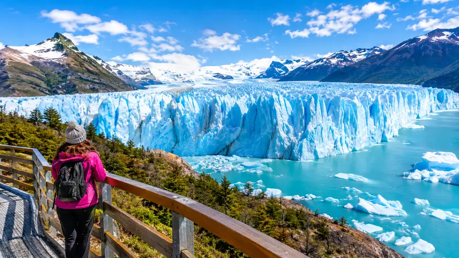
Perito Moreno is one of the few glaciers on earth that remains roughly in equilibrium rather than retreating at breakneck speed. It measures 30 kilometers in length, spans 5 kilometers across its front wall, and rises an average of 74 meters above the water line. When you stand on the lower observation deck, looking up at towers of ice the size of twenty-story apartment buildings, the scale defies logic. The ice isn't purely white. Mineral compression squeezes air bubbles out of the ancient layers, absorbing every wavelength of light except deep sapphire blue.
You can explore the site from several angles, depending on your budget and mobility. Most people spend three to four hours walking the steel boardwalks, which loop down toward the ice face with remarkable accessibility. But you can also take boat tours departing from Puerto Bajo de las Sombras that skim along the southern wall, or embark on guided ice trekking on Perito Moreno with crampons strapped to your boots.
There are other giants hidden in the park waters. Catamarans depart from Puerto Bandera, 47 kilometers outside El Calafate, taking travelers deep into the northern arm of Lake Argentino. Here you find Upsala Glacier, a sprawling monster of ice that has retreated dramatically over the past two decades, leaving behind enormous blue tabular icebergs adrift in the channel. The boat routes also cruise past Spegazzini Glacier, whose front wall rises over 130 meters above the lake, dwarfing Perito Moreno in pure vertical height.
- Steel boardwalk network: four distinct color-coded circuits ranging from 1 to 3 kilometers, offering direct panoramic views from multiple elevations.
- Safari náutico boat trips: short 45-minute sailings beneath the southern ice wall, ideal for feeling the cold downdraft coming off the seracs.
- Minitrekking excursions: guided walks across the undulating glacier surface, requiring moderate fitness and minimum age limits.
- All-day lake navigation: long catamarans heading out across the northern reaches of Lake Argentino toward Upsala and Spegazzini.
Hiking El Chaltén: Trails in the Shadow of Fitz Roy
Three hours north of the southern ice walls, the landscape changes completely. El Chaltén sits nestled inside the glacial valley carved by the Fitz Roy River. The town is tiny, walkable in twenty minutes, and completely devoted to trail culture. You will see people walking down the gravel side streets in trekking poles and muddy boots at ten o'clock at night looking for craft beer and fresh empanadas.
The premier trail in the region is Laguna de los Tres. The hike covers roughly 21 kilometers round trip, climbing through lenga forests and open meadows before tackling an unforgiving final kilometer over steep moraine rock. That single kilometer gains nearly 400 vertical meters. It burns your quads and tests your footing on loose stones, but cresting the ridge reveals a cobalt glacial pool sitting beneath the granite spires of Mount Fitz Roy. Standing there with the wind whistling off the rocks, you understand why people travel thousands of miles to visit Argentine Patagonia.
Pro tip: Start your Laguna de los Tres hike before 6:30 AM. You avoid the large groups dumped by tour buses around nine, and you catch early morning light hitting the granite walls.
For an equally rewarding day with gentler elevation gains, Laguna Torre leads 9 kilometers each way along the Rio Fitz Roy to a glacial lake filled with drifting icebergs shed by the Torre Glacier. At the back of the bowl stands Cerro Torre, a needle-thin spire of rock capped by a precarious mushroom of rime ice that remained one of mountaineering's most legendary challenges for decades. The trail is mostly flat, rolling through quiet woods where Magellanic woodpeckers drum against dead trees.
Book your perito moreno glacier tour experience:
Logistics, Passes, and Navigating the Park
Sorting out transport in Patagonia takes foresight because public transit does not run on whim. The main commercial airport for the region is Comandante Armando Tola International Airport (FTE) just outside El Calafate. Daily flights arrive from Buenos Aires on Aerolíneas Argentinas, Flybondi, and JetSmart, taking about three hours and twenty minutes. If you are heading straight to El Chaltén, private transfer vans and scheduled public buses can pick you up directly from the airport terminal without needing to stop overnight in El Calafate.
Figuring out getting to the glacier from town requires picking between shared coach services, guided agency tours, or a rental car. Buses leave the El Calafate terminal twice a day, usually around 8:00 AM and 1:00 PM, giving you about four to five hours on the catwalks before hauling everyone back. A rental car offers flexibility, letting you stay until late afternoon when the light softens and ninety percent of the tour groups have cleared out to their hotels.
- Entrance ticket validity: tickets for the Perito Moreno sector are bought online through the official national parks portal or in Argentine pesos at the entrance gate.
- Second-day discount: if you visit the southern glacier sector two days in a row, the park system grants a fifty percent discount on the second day ticket when purchased within 72 hours.
- Connectivity realities: cell service drops completely twenty minutes outside both El Calafate and El Chaltén, so keep all trail maps downloaded offline.
- Currency recommendations: park kiosks and shuttle buses often struggle with card terminals due to weak satellite signals, making cash pesos indispensable.
Packing for this region is an exercise in preparation. Weather systems arrive off the Pacific with minimal warning. A bright, sunny morning with blue skies can shift into driving horizontal sleet by 1:00 PM, only to clear back up into warm sunshine two hours later. Layering is not optional advice here; it is survival. A solid waterproof outer shell, fleece mid-layers, thermal leggings, and sturdy ankle-support boots are mandatory if you plan on stepping foot onto the backcountry trails.
Wildlife and Landscapes of the Southern Andes
Despite the harsh climate, the park supports a surprisingly dense collection of native wildlife. Across the steppe between Calafate and Chaltén, you will regularly spot small herds of guanacos, wild camelids closely related to llamas. They graze in family groups on coarse tussock grass, leaping effortlessly over standard barbed-wire fences that divide cattle estancias. Overhead, Andean condors use the thermal updrafts along the ridge lines, soaring with three-meter wingspans without flapping for minutes on end.
Inside the dense southern beech forests of lenga and guindo, you might catch a rare glimpse of the huemul, an endangered South American deer that features on the Chilean coat of arms. Only an estimated two thousand individuals survive across Patagonia, with a healthy pocket sheltering within the protected boundaries of Los Glaciares. If you do see one near the trails, keep your distance. They have very little natural fear of humans, which historically made them vulnerable to hunting.
The flora tells its own story of resilience. In spring, the scarlet blooms of the notro bush light up the forest edges, while calafate bushes produce dark blue berries that locals turn into jam, ice cream, and craft gin. Local lore claims that anyone who eats the wild calafate berry is cursed or blessed to return to Patagonia someday. After watching the sun sink behind the ice fields from an empty ridge, you will probably want to return anyway.
Frequently Asked Questions about los glaciares national park
Where is Perito Moreno Glacier located exactly?
The glacier sits in southwestern Argentina within Santa Cruz province, roughly 78 kilometers west of the town of El Calafate on the southern shore of Lake Argentino.
How many days do you need to see Los Glaciares National Park?
Plan on at least four full days. Spend two days based in El Calafate to see Perito Moreno and explore the lake, followed by two to three days in El Chaltén for hiking the Fitz Roy trails.
Can you visit both sectors without renting a car?
Yes. Regular long-distance buses run between El Calafate and El Chaltén multiple times per day from October through April, taking about three hours each way.
When is the best time of year to visit?
The peak season runs from November through March, offering longer daylight hours and milder temperatures, though late shoulder season in April brings striking fall foliage and lighter crowds.
Quick Reference
- Total park area covers 7,269 square kilometers of ice and mountain terrain.
- Primary airport hub is El Calafate (FTE), located 20 km east of town.
- Summer daylight lasts past 10:00 PM in December and January.
- Main highway link between sectors is scenic National Route 40.
Book your perito moreno glacier tour experience:
The Bottom Line
Los Glaciares is not a manicured theme park you can absorb from the window of a tour bus. It demands your attention, your patience with the wind, and some wear on the soles of your shoes. Whether you spend your time sitting quietly on a boardwalk bench waiting for another house-sized chunk of blue ice to drop into Lake Argentino, or you haul yourself up the steep moraine to Laguna de los Tres at dawn, this corner of Patagonia resets your perspective on how grand the natural world can be. Pack your waterproof layers, pull on your boots, and head south.
Read more about perito moreno glacier tour.