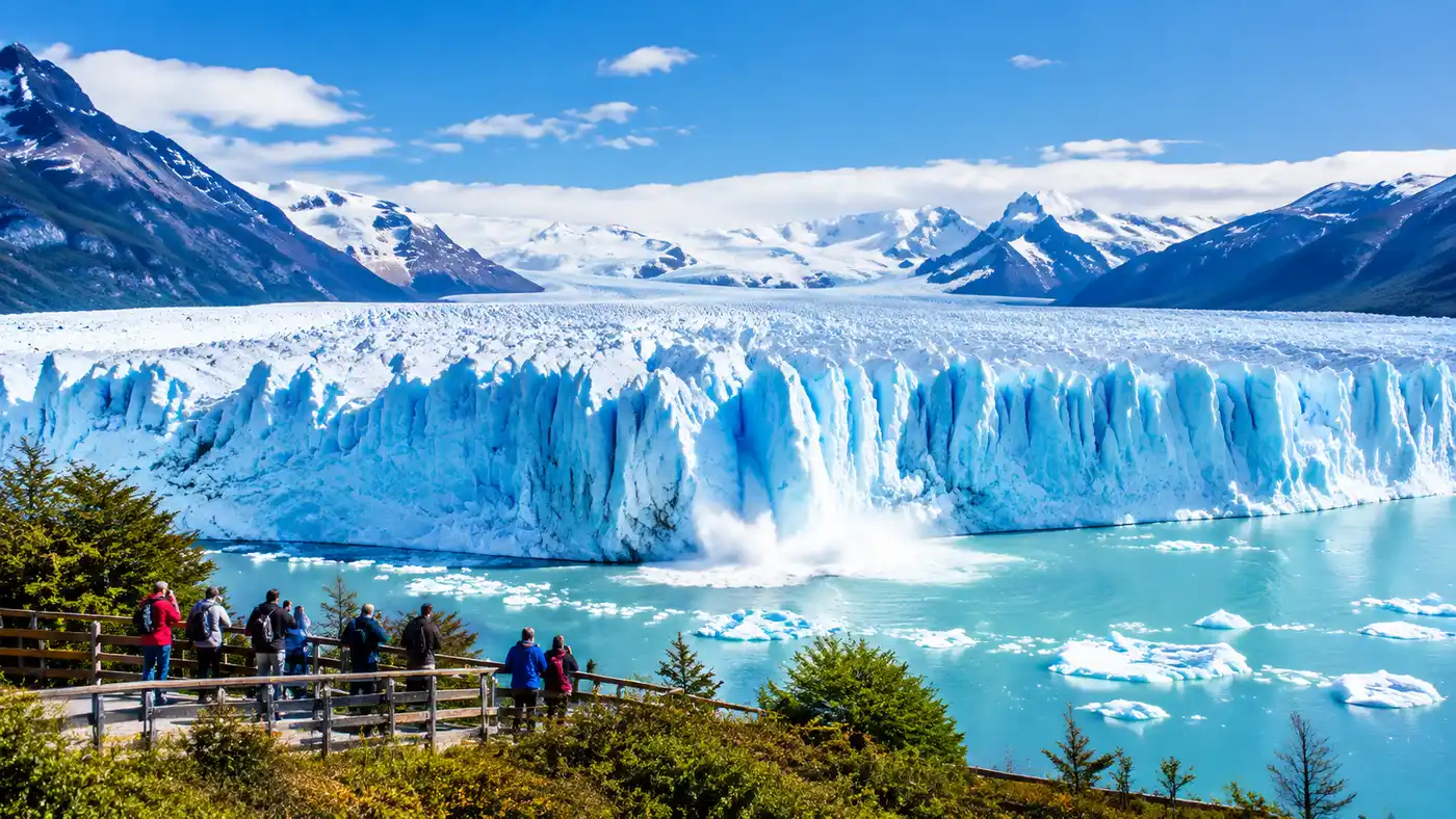
Perito Moreno Glacier Facts: Height, Size, and Rupture
You hear it long before you see the ice break. It sounds like artillery fire echoing across the water, a dry crack that makes everyone on the viewing deck freeze in place. Most people arrive with a list of fun facts about perito moreno glacier in their heads, expecting a static block of white ice tucked into a quiet valley. What you actually get is a 250-square-kilometer frozen monster that groans, shudders, and throws five-story chunks of itself into Lake Argentino whenever it feels like it.
I spent three days watching this beast from different angles, and it completely ruined all other glaciers for me. It sits inside Los Glaciares National Park in southern Argentina, roughly 78 kilometers from the dusty hub of El Calafate. Understanding how it moves, why it dams an entire lake, and whether it is actually shrinking gives the whole place a different gravity. Here is what is really happening beneath that jagged blue surface.
Book your perito moreno glacier tour experience:
How Big Is Perito Moreno Glacier? Height, Width, and Depth
Numbers do not do much when you are standing on the lowest platform, staring up at a wall of solid ice that blocks out the horizon. Still, the dimensions help explain why your brain struggles to process the scale. The terminus wall rises about 74 meters above the surface of Lake Argentino. That is roughly the height of a 24-story apartment building. What you see above the water line is barely a fraction of the total mass. The ice drops another 170 meters straight down into the glacial trench, meaning the total ice thickness at the front edge exceeds 240 meters.
The glacier stretches roughly 30 kilometers from its birthplace high in the Andes down to the lake. At its front face, it spans five kilometers across the water. If you look at satellite imagery of the Southern Patagonian Ice Field, Perito Moreno looks like a frozen tongue pushing east into the turquoise water of Canal de los Témpanos. It is not the biggest glacier on the continent - Upsala Glacier further north is far larger - but Perito Moreno is famous because it reaches low elevation, terminating at just 180 meters above sea level. That low altitude makes it one of the easiest glaciers on earth to visit on foot.
| Glacier Metric | Measurement | Context |
|---|---|---|
| Visible Wall Height | 74 meters (243 feet) | Measured above lake surface |
| Submerged Depth | 170 meters (558 feet) | Rests on the lakebed floor |
| Total Ice Thickness | 244 meters (800 feet) | Terminus front wall total |
| Terminus Width | 5.0 kilometers (3.1 miles) | Across Canal de los Témpanos |
| Total Length | 30 kilometers (18.6 miles) | From Andean crest to front |
| Surface Area | 250 sq km (97 sq miles) | Roughly the size of Buenos Aires city |
When tourists ask about altura glaciar perito moreno or cuanto mide el glaciar perito moreno, they usually focus on the front wall. But walking along the northern face tells a different story. The ice pushes forward at a speed of around two meters per day in the center, grinding bedrock into fine powder that turns the water an opaque milky blue. You can see this milky silt swirling near the ice edge if you take a catamaran boat ride across the bay.
The Great Rupture: When the Ice Dam Bursts
Every few years, Perito Moreno does something rare in glaciology. It crawls across the water and runs straight into the rock face of the Magallanes Peninsula. When the ice makes contact with the shore, it divides Lake Argentino into two separate bodies of water. The southern arm, called Brazo Rico, gets completely cut off from its natural drainage route into the Santa Cruz River.
With nowhere to go, water from rain and melting mountain streams backs up rapidly. The water level in Brazo Rico begins to climb, often rising 10 to 15 meters above the level of the main lake. The hydrostatic pressure becomes absurd. Millions of tons of water push against the side of the glacier wall, scouring tiny channels through weak seams in the ice. Over weeks, these channels widen into a massive natural bridge.
Note: There is no fixed schedule for the ice bridge collapse. Park rangers cannot predict it a year in advance, and anyone selling tour tickets based on a guaranteed rupture date is lying to you.
Eventually, the hollowed-out bridge cannot support its own weight. The structure weakens until the roof thins to a few meters, and the whole span caves in with a deafening roar. The water drains through the breach in a violent surge, restoring equilibrium between the two lakes. The collapse has occurred every two to four years historically, though intervals have stretched up to sixteen years in the past. When the rupture happened in March 2016, thousands of visitors camped out on the balconies for two nights just to watch the arch give way in broad daylight.
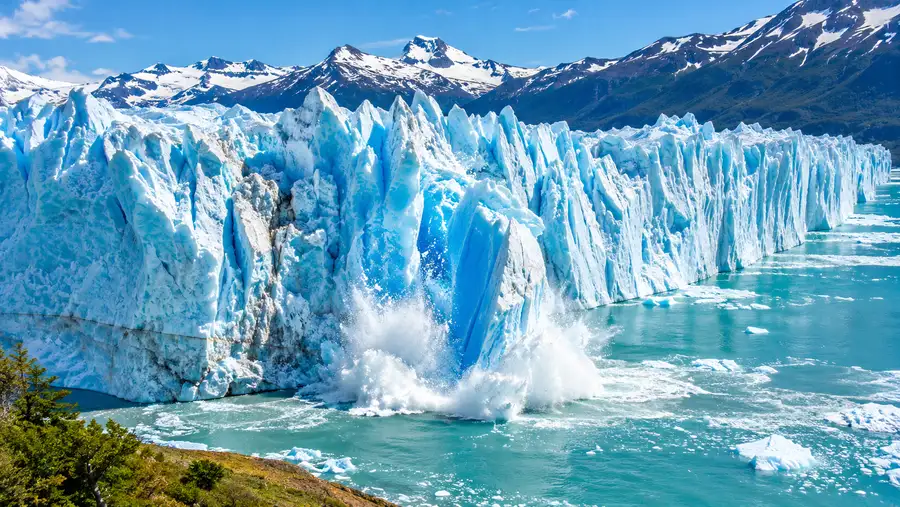
Is Perito Moreno Glacier Retreating or Still Growing?
For almost fifty years, travel guides and park brochures repeated the same line: Perito Moreno is one of the few glaciers on earth that is growing, or at least in stable equilibrium. That claim was true for a long time. While glaciers across the planet were pulling back up their mountain valleys, Perito Moreno held its ground, advancing slightly in winter and shedding ice in summer without losing net mass.
That balance is broken. Satellite data and ground monitoring over the past decade show that Perito Moreno is losing ice mass, joining the worldwide trend of glacial recession. The change is subtle if you only glance at the front wall from the main viewing decks, because the glacier still touches the Magallanes Peninsula during advance cycles. But glaciologists tracking surface elevation have found that the glacier is thinning by several meters per year near the tongue.
Pro tip: Head to the lower southern balconies along the walking network around 2:00 PM; the afternoon sun warms the northern and central walls, triggering the most active calving runs of the day.
Recent studies by Argentine and international researchers confirm that the northern flank has begun pulling away from the shoreline, showing signs of retreat that were never documented throughout the twentieth century. Warmer air temperatures over the Patagonian ice field mean winter snowfalls no longer pack enough mass onto the accumulation zone to balance the summer melting down below. It is not vanishing overnight, but the narrative that this glacier defies climate change is officially dead.
Book your perito moreno glacier tour experience:
Origins, History, and Geological Anatomy
How was the perito moreno glacier formed? The story starts during the Last Glacial Maximum, around 20,000 years ago, when a thick sheet of ice smothered vast stretches of southern Chile and Argentina. As the planet warmed, that ice sheet broke into smaller fragments. What remained high in the southern Andes became the Southern Patagonian Ice Field, which today ranks as the third-largest reservoir of fresh water in the world, trailing only Antarctica and Greenland.
Perito Moreno is an outlet glacier fed directly by this high-altitude ice plateau. Storms sweeping off the Pacific Ocean smash into the Andean crest, dumping up to 8,000 millimeters of precipitation every year as heavy snow. The snow compresses under its own weight, squeezing out air bubbles over centuries until it transforms into dense, blue glacial ice. Gravity does the rest, forcing the river of ice down the valley toward Lake Argentino.
- Glacier classification: temperate valley glacier with a grounded calving terminus.
- Estimated age: the current ice moving through the front wall fell as Andean snow roughly 400 to 500 years ago.
- Namesake origin: named after Francisco Pascasio Moreno, an Argentine explorer who surveyed the border region in 1877, though he never actually laid eyes on this specific glacier.
- Basal condition: the glacier sits directly on wet bedrock and saturated sediment, allowing the entire ice sheet to slide rapidly with little friction.
The blue color that catches everyone off guard is simple physics. Glacial ice is so compressed that the crystals absorb red, yellow, and green wavelengths of light, reflecting back only deep blue. Fresh surface snow looks white because it contains air pockets that scatter all light wavelengths equally. When you see a shard of ice floating in the water that looks like blue glass, it means that chunk was buried deep inside the glacier under immense pressure for hundreds of years before breaking loose.
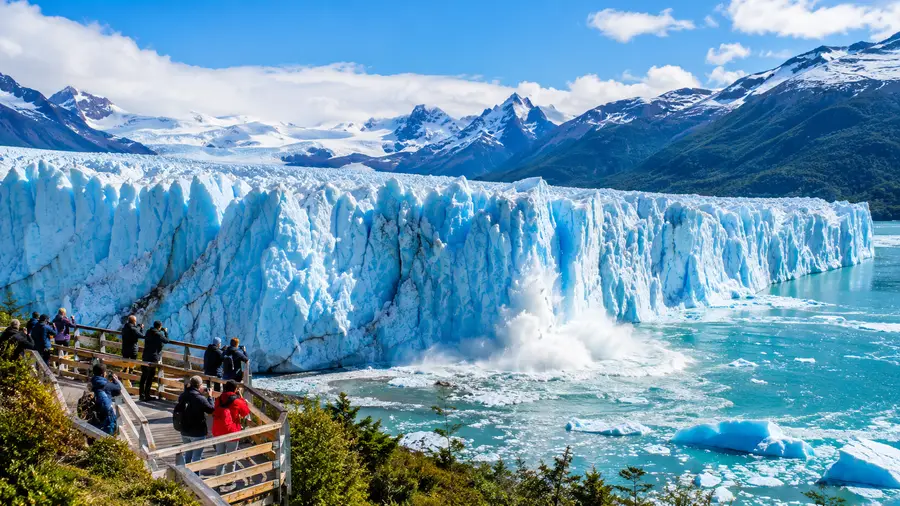
The Physics of Calving and What It Sounds Like
Calving is the process of ice chunks breaking away from the front wall and crashing into the water. Most people assume calving happens because the sun melts the front of the glacier. Heat plays a small role, sure, but the real culprit is water buoyancy and internal stress. Because the glacier is grounded on the lakebed, lake water pushes upward against the submerged snout while gravity pulls down on the exposed wall above.
That push-and-pull cracks the ice from the inside out. Long vertical fissures, called crevasses, open up behind the front face. As the glacier crawls forward, these slabs lose balance and topple into the water. Sometimes an ice pillar simply slides straight down into the depths. Other times, a slab as large as a twelve-story building peels off, pivots outward, and smacks the water flat, sending a three-meter wave rolling toward the shoreline.
- The warning shot: a sharp acoustic pop usually precedes a calving event by two to five seconds, giving you just enough time to point your camera.
- Underwater calvings: occasionally, buoyancy forces a massive piece of submerged ice to detach from the bottom and breach the surface like a surfacing blue whale.
- The wave delay: after a large chunk hits the lake, the resulting surge takes about 45 to 60 seconds to reach the rocks below the viewing decks.
The best way to see this up close is from the network of walkways and viewing balconies built across the face of the peninsula. The trails drop you down to within a few hundred meters of the ice wall. Standing on those metal steps in the cold wind, listening to the creaking ice while watching sparrows flit through the lenga beech trees right beside you, is surreal. It feels alive. Most landscapes in Patagonia feel ancient and finished, but Perito Moreno is being carved right in front of you every single second.
Frequently Asked Questions about fun facts about perito moreno glacier
Is Perito Moreno Glacier the biggest glacier in the world?
No, not even close. The largest glacier on earth is the Lambert Glacier in Antarctica, which covers over one million square kilometers. Perito Moreno is not even the largest in Argentina - that title belongs to Upsala Glacier, which covers over 800 square kilometers within the same national park.
Why does the glacier look so blue?
Centuries of intense pressure squeeze almost all the air bubbles out of the ice. Without trapped air to scatter sunlight, the dense ice absorbs longer wavelengths like red and orange, reflecting back shorter blue light to your eyes.
Can you walk on top of the Perito Moreno Glacier?
Yes, guided ice trekking excursions operate daily between late September and May. You take a short boat across the lake, strap steel crampons onto your hiking boots, and walk across the seracs, meltwater streams, and crevasses with licensed alpine guides.
How deep is the lake under the glacier?
Lake Argentino reaches depths of up to 170 meters (558 feet) at the glacier face, and drops to more than 500 meters deep in other parts of the southern branch, making it one of the deepest lakes in South America.
Quick Reference
- Total surface area: 250 square kilometers
- Wall height above lake: 74 meters
- Total ice depth: 244 meters
- Movement rate: roughly 2 meters per day
Book your perito moreno glacier tour experience:
Before You Go
If you are planning to visit, give yourself a full afternoon instead of the quick two-hour tour bus stop. Pack a windproof jacket, some warm gloves, and sit on the lower wooden catwalks with a thermos of hot coffee. Watching a five-hundred-year-old chunk of ice peel away from the wall and thunder into the lake below is something you will never forget. Don't worry about trying to photograph every crack you hear - just stand there, watch the blue water swell, and take in one of the wildest sights left on our planet.
Read more about perito moreno glacier tour.